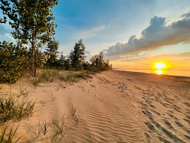
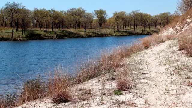
Choose the lakefront visit you want
Choose a Miller Woods walk for dunes, woodland and wetland habitats; choose the Paul H. Douglas Center for an environmental-education visit; or use the Marquette Park map to organize a city-park, pavilion or beach outing. Select the specific entrance before arranging transport. The places share a lakefront setting but have different managers, facilities and practical decisions.
For the trail, open the current NPS Miller Woods page. For the city park, use Marquette Park maps and rules. Check park conditions, the weather and any relevant beach information for the actual date. Sources reviewed .
This is a practical visit guide to the Gary, Indiana lakefront. For city services and other destinations, use the Indiana city hub; for a train journey, use the Chicago transport guide. Keep the local outing and the journey to it together in your plan.
Understand the names before placing a map pin
Miller Beach is the broader place name used for this part of Gary's lakeshore. Miller Woods is the National Park Service destination associated with the Paul H. Douglas Trail and education center. Marquette Park is the municipal park with its own mapped beach, buildings, picnic areas and event spaces. Miller station is a transport boarding point. Choosing any one of these names does not automatically select the entrance to the others.
| Main activity | Source to open | Decision to make |
|---|---|---|
| Woodland and dunes walk | NPS Miller Woods | Shorter loop or longer beach route. |
| Environmental learning | Douglas Center | Building visit or a dated program. |
| Park, picnic or architecture | Marquette map | The particular public area or venue. |
| Water access | Beach manager, signs and current advisories | The exact beach and conditions. |
| Rail arrival | South Shore Line stations | Station entrance and the final local leg. |
Save the chosen destination's full address alongside its name. If meeting friends, agree an entrance or building rather than “the beach.” This matters most when the group arrives in separate vehicles or by different modes. One clear meeting description prevents a shared place name from producing several different arrivals.
Pick the Miller Woods route before you start
The NPS trail page describes a 0.9-mile Douglas Center loop and a 3.4-mile beach trail, with the beach trail rated moderate. Its listed trailhead is 100 North Lake Street, Gary, IN 46403. Use the published trail map with those named routes instead of joining paths from several map results into an assumed itinerary.
NPS publishes these distances in miles. For visitors planning in metric units, 0.9 mile is approximately 1.45 kilometers and 3.4 miles approximately 5.47 kilometers, calculated using 1 mile = 1.609344 kilometers. These are conversions of the published route lengths, not a separately measured route or a prediction of walking time.
Choose the shorter loop when the priority is a manageable introduction to the surroundings or when the rest of the day has a fixed appointment. Consider the longer beach route when the group wants the walk itself to be the main activity and can manage the surface and return. These are planning choices, rather than a claim that one distance suits every visitor.
For an out-and-back component, the point where you reach the lake is an intermediate point in the outing. Keep the return effort in mind while choosing pauses and side interests. Use a turnaround decision that the group understands, especially when a later journey has a fixed limit. The person who wants the fastest pace should not set the only workable return plan.
Download the manager's map before setting out and identify the route on it. At a junction, compare the route name, sign and map together. A continuous-looking line on a general map may not explain a managed trail or a temporary closure. The useful plan is the named walk you actually intend to follow.
Give the habitats their own place in the visit
The NPS description of the Paul H. Douglas Trail connects wetlands, black oak savanna, open dunes and the lakeshore. That variety makes the walk more than a route to the beach. Let the group choose whether the main interest is landscape, birds, plants, photography or simply time outdoors, then allow pauses that fit that purpose.
Notice transitions from one setting to another: an open area, a pond edge, more sheltered woodland or exposed sand. You do not need to identify every plant to make those observations meaningful. A simple field note can record the location, visible setting and question to investigate later. Keep an uncertain identification as a question until a suitable source or knowledgeable person can help.
For children or a mixed-interest party, choose one shared observation task, such as comparing how the ground surface or shelter changes. This gives pauses a purpose without turning the outing into an examination. The same approach helps a photographer avoid spending the whole walk looking only for a single familiar beach view.
Keep observations on the managed route. The park's information explains that leaving the trail can damage fragile habitat. A useful nature record does not require collecting a specimen or approaching wildlife. Save a photograph and a location description when appropriate, then take the question back to the center or another suitable learning resource.
Plan the Douglas Center as a destination in its own right
The Paul H. Douglas Center is an environmental-education center with exhibits and interpretation linked to the surrounding landscape. A building visit, a ranger-led activity and an independent trail walk are separate experiences. Decide which one is the reason for your trip before adding the others.
If a particular program matters, find its dated official listing and confirm the participation arrangement. Record the meeting point, intended audience and any booking or preparation instructions. A general description of the center's educational role does not establish that a particular activity will run whenever you arrive.
For someone who prefers a shorter outdoor visit, the center can be the anchor around which the group makes its own choices. Ask about the facilities needed for that individual visit, then decide whether a nearby outdoor component fits. Do not make everyone's experience depend on one person completing a route they have not chosen.
Use the center's interpretation to sharpen a question for the walk, or use the walk to identify something to ask about afterwards. This creates a useful connection between indoor and outdoor time. Check the building's current opening information when sequencing the two, rather than assuming that it will remain available after the group finishes a longer route.
Use Marquette Park's map to choose the right area
The city's Marquette Park information describes a 241-acre park in Gary's Miller Beach community. Its numbered map separates the Pavilion, picnic facilities, Patterson Island and bridges, designated beach, event space and other features. Use those labels to select an activity and meeting place.
Architecture and a park visit
The Pavilion and Aquatorium are different buildings. Look up the feature you want to see and keep the appropriate name in the plan. A public park setting does not establish public entry to every room or an event being hosted inside. If a building interior or organized activity is essential, verify that access through the venue.
Picnic space and event space
A family picnic, a reserved shelter and a large public event need different arrangements. The city identifies designated picnic facilities and rental information. Start with the activity's scale and equipment, then ask whether the intended area or setup needs a reservation. A place being empty in a photograph does not show its availability for your date.
Waterfront and designated swimming area
Use the beach's own signs and current manager information to identify where the intended activity is allowed. A long stretch of visible shoreline is not one uniform facility. The map helps orient the group, while the instructions at the specific beach and any current closure determine how that day's visit works.
The park contact page lists 1 North Grand Boulevard, Gary, IN 46403 for Marquette Park. Confirm the arrival point for the actual feature or event; a general park address is a useful starting point rather than a parking instruction for every activity.
Resolve the station, entrance and final local journey
The South Shore Line station page lists Miller at 760 S. Lake Street. The NPS trailhead and Marquette Park have different addresses. Plot the link from the station to the selected entrance before treating a rail trip as a complete beach itinerary.
If using a bus for any part, check the GPTC route information for the date, stop and return direction. If being collected, agree the actual pickup point with the driver. Avoid leaving the last leg as “we will find something nearby,” especially when the group has luggage, equipment or a fixed return connection.
For a car arrival, use the destination's current parking guidance and on-site signs. A park lot and a trailhead lot can have different conditions. Decide whether the group will remain at one place or move between sites; that affects how you carry food, equipment and belongings. Keep the vehicle's location clear in the group plan when more than one entrance is possible.
The Gary–Chicago transport guide covers station selection and timetable reading in more depth. On this page, the important step is to connect that main journey to the specific lakefront activity rather than assuming that every place carrying the Miller name has the same arrival.
Check charges for the specific site
The direct NPS Miller Woods page, updated October 13, 2026 and reviewed for this guide, states no passes are required for the Paul H. Douglas Trail information it describes. Keep that statement scoped to this location. It does not settle admission or parking at every Indiana Dunes or city-managed destination.
When comparing a day with several stops, make a separate line for each parking, entry or reservation question. Obtain the applicable terms from that manager rather than applying one national-park rule to the entire lakefront. If a ticket, pass or reservation is needed elsewhere, record what it covers and the date of use.
For a reserved park facility, distinguish access to the venue from the equipment and services included in the reservation. The organizer should confirm the relevant conditions before telling the group what will be available. A normal visitor plan and an event booking have different obligations even when both begin with the same park map.
This approach also makes a budget more useful: confirmed charges stay separate from questions still to resolve. You can then decide whether to keep the original plan, choose another available activity or reduce the number of separate stops.
Use weather, water-quality information and local signs together
The National Weather Service beach-hazards resources address waves and swimming risk. Indiana's beach monitoring program provides the route to BeachAlert for water-quality advisories and closures at participating beaches. These sources answer different questions; check the one relevant to the beach and activity you have chosen.
Read the date and beach identity on a result. A forecast for another part of the lake or a sample from a previous date does not establish conditions at your chosen access point now. Use the posted sampling date and the beach manager's current notices together when reviewing a result.
Marquette Park's own rules page contains conflicting statements about lifeguard hours. This guide therefore does not publish a coverage schedule. Confirm the current arrangement with the manager and posted information, and follow closures or restrictions at the site. A lifeguard description in an older listing should not decide whether the day's water activity goes ahead.
Agree an alternative that still makes the outing worthwhile if entering the water is unsuitable: a different permitted park activity, the education center when open, or a shorter visit. Making that decision before arrival keeps the day from depending on a single activity that the current conditions may not support. Use NPS safety guidance for park-managed places.
Pack for the route and the way you are arriving
Build the packing list from the chosen activity. A longer sand walk, an indoor center visit and a park picnic place different demands on what you carry. Start with what each person needs for the planned duration, the forecast and the return journey. Then remove items that only make sense for an optional activity you have not actually arranged.
Keep walking equipment manageable on the route's surface. Someone arriving by train also has to carry it through the station and the final local leg. A useful group plan identifies shared items and avoids asking one person to carry an impractical load. Decide where food and other belongings will remain while the group changes activity.
Save the relevant map, destination address and transport record in a form you can read away from a reliable connection. Protect important documents and a phone in a manner appropriate to your outing. Keep payment and booking confirmations accessible to the person responsible for using them, while leaving sensitive account information out of a shared itinerary.
At the end, account for equipment and litter before leaving the meeting place. This is particularly helpful when a group has spread between a picnic area and another activity. A simple departure check is easier than discovering on the return journey that a bag or essential item remained at the previous stop.
Match access needs to the actual route
The NPS accessibility description distinguishes accessible center facilities and the walkway toward the marsh boardwalk from trails described as not wheelchair accessible. Use that distinction when selecting the experience. An accessible building and a suitable trail journey are separate questions.
Describe the required experience in concrete terms when asking the manager for advice: the intended entrance, how far the person wishes to go, relevant surface or slope constraints, and whether restrooms or a place to rest are needed. The most useful answer relates those needs to a specific route or facility rather than a broad label attached to the destination.
For a group, decide whether everyone wants one shared activity or whether two compatible options would work better. If splitting temporarily, agree the meeting point, responsible contact and reunion time. Keep the shorter option an actual worthwhile visit, rather than a waiting arrangement for those who do not take the longer walk.
Include the arrival and departure in the access enquiry. A suitable facility can still be difficult to reach from the chosen parking place or station. Confirm the available entrance and the last connection, and make any required assistance arrangement with the responsible provider. This gives the group an end-to-end plan without assuming that one general accessibility statement settles every part.
Give families a plan with choices
Choose an activity that the people taking part can realistically enjoy together. For a family new to the area, that might be an education-center visit with a shorter outdoor component, or one defined park activity. A beach destination at the end of a longer walk should be chosen because the walk fits the group, rather than because the place name sounds familiar.
Explain the shape of the outing before beginning: the first stop, where a pause is planned and how the group will return. Give children a simple way to participate, such as choosing an observation to share at the next pause. Let the plan adapt to the experience instead of requiring completion of every optional stop.
For two households meeting, agree who is bringing shared items, who has transport details and where a change of plan will be communicated. A clear meeting point is useful when one party reaches the park earlier. Avoid sending a late arrival an unlabelled photograph that could show several different entrances.
Keep destination rules attached to the chosen area. A picnic space, a managed swimming area and a nature trail have different practical boundaries. Read the relevant signs together on arrival, then choose an activity everyone understands. A single short orientation at the actual place is more useful than assuming everyone saw the same links before leaving home.
Check dog and bicycle plans against each area
The Miller Woods rules permit leashed pets, specify a leash of six feet or less, and prohibit bicycles on the trails. A rail operator permitting a bicycle does not make it suitable for this particular walking route. Decide what will happen to the bicycle before making it essential to the visit.
The city's Marquette rules distinguish swimming areas, where animals are restricted except for the stated service-dog provision, from another beach area east of Montgomery Street where dogs must be restrained. Check the current area-specific signs and manager guidance. Do not turn one part of that page into a blanket rule for every stretch of shoreline.
If bringing a dog, select a permitted activity from the beginning and account for the rest of the group. An indoor stop, a reserved event or a swim may introduce a different requirement. Resolve that with the relevant manager before arranging a sequence that leaves no practical option for the animal or its handler.
If arriving by bicycle, use the transport operator's bicycle conditions and the destination's rules separately. Confirm a lawful route and suitable place to leave the bicycle if the main activity is on foot. This keeps an otherwise appealing transport choice from creating an unresolved problem at the trail entrance.
Put a picnic in the designated place
Marquette Park's map identifies picnic grounds and facilities separately from the beach. Its published rules prohibit open fires, grills and glass on the beach while identifying designated picnic and grilling grounds elsewhere. Use the relevant designated area and its current instructions when arranging a meal, rather than treating the whole park as one interchangeable space.
For a small picnic, decide how the food will be carried, where the group will gather and what happens if the preferred area is unavailable. For a larger organized gathering, use the park's rental and permit route to confirm the appropriate setup. The organizer should know which area has actually been reserved before directing guests there.
Choose a meal plan that fits the rest of the outing. Carrying an elaborate picnic through a longer trail route can change the effort and timing substantially. If the picnic is the main social activity, it may be more useful to anchor the day there and make a separate short walk optional.
Before leaving, restore the area and gather the group's belongings. Use the site's waste arrangements and take responsibility for material that cannot be deposited there. A clear division of shared tasks makes departure quicker, particularly when some visitors must catch a fixed return service.
Adjust the activity when the season changes
Choose a visit for the conditions expected on the actual date, rather than the appearance of a summer photograph. An exposed beach and a sheltered woodland segment can feel different during the same outing. Use the forecast, the manager's current information and the group's requirements to decide the appropriate duration and activity.
For an outdoor-led plan, keep the main interest clear even when swimming is not part of the visit. Landscape observation, a shorter walk and an open education-center visit are different ways to use the area. Confirm the relevant access and opening arrangements for the selected option instead of assuming a seasonal activity continues unchanged throughout the year.
A photograph made in another season is useful for understanding the place but should not establish today's vegetation, water level or available facilities. The same applies to an old event post. Keep a dated current source with any activity whose opening or operation determines whether the trip works.
Revisit transport as well as the destination when changing the outing. Shortening a walk may create an earlier return opportunity, while moving indoors may involve another entrance or booking. Update the group plan as one whole itinerary so everyone knows which stop has changed and how the revised day finishes.
Choose one of three flexible visit patterns
A short introduction
Make the Douglas Center or a shorter named walk the anchor. Check that the desired facility is available, arrive at the correct entrance and leave the longer beach route for another visit if it does not fit the group. Use one landscape observation or an exhibit question to give the outing focus. Add a separate meal only after the return arrangement is comfortable.
A walking-led day
Choose the published Miller Woods beach route, read the map and let the walk be the principal activity. Plan pauses and the return as part of the same route. Keep any later park or neighborhood stop optional. This pattern suits a group that values the walking experience itself; it should not depend on treating the lake as an easy halfway point regardless of conditions.
A city-park gathering
Select a particular Marquette Park feature or designated picnic area. Confirm the arrangement that applies to your group, use the map to set the meeting place and tell everyone which entrance to use. Keep a separate beach activity dependent on that day's conditions. A visitor interested in architecture can research the Pavilion or Aquatorium without assuming entry to a private event.
These are original planning frameworks, with no invented start times or confirmed reservations. Fill in the date, available facilities and transport from the responsible sources before using one. The value is in making the main decision clear: a short learning visit, a substantive walk or a park gathering. Combining all three is optional and should depend on the actual time, access and interests of the people travelling.
Connect the shoreline with the people who used it
The lakefront has a history as well as a landscape. The NPS account of Drusilla Carr describes a resident and fishing family's connection to land around today's Marquette Park and Miller Woods, including a long dispute over valuable beachfront property. The account gives a human context to a place that can otherwise be described only as sand, woodland and public recreation.
The NPS biography of Octave Chanute places the first of his 1896 glider-testing camps at Millers, within today's Gary. It also distinguishes that site from a later camp elsewhere along the dunes. When using an aviation association to plan a visit, keep the particular site and event together; a shared lakeshore does not make every experiment the same event in the same place.
These stories can give a short outing a focus without turning it into a search for unverified remains or access to private property. Read one account beforehand, then look at the wider setting from an authorized public place. Use the history guide if you want the fuller chronology and the records behind it.
Make a photograph useful after the visit
Keep the place name, date and subject with your photographs. A label such as Marquette Park Pavilion, Gary, Indiana is more useful later than an unlabelled image of a building. If the photograph includes an interpretive panel, record the panel's identity and publisher so that its information can be checked separately from your view of the place.
When sharing a photograph, describe what it actually shows. A beach view made on one visit does not establish water conditions for another day. An exterior view does not prove indoor access. Avoid calling another photographer's nearby or regional scene Gary unless its location is documented. This simple habit makes a personal trip record helpful to future visitors without asking a photograph to answer questions it cannot settle.
Questions about visiting Miller Beach
Is Miller Woods the same place as Marquette Park?
They are different managed destinations in Gary's lakefront area. Use NPS information for Miller Woods and the city park's map for Marquette. Select the specific entrance for your activity.
Which Miller Woods walk is shorter?
NPS describes a 0.9-mile Douglas Center loop and a 3.4-mile beach trail. Use the current map and route conditions to select the outing.
Do I need a national-park pass for Miller Woods?
The direct NPS Miller Woods page reviewed October 31, 2026 states no passes are required for this location. That does not establish the rules or charges at other park or city-managed sites.
Can I cycle the Miller Woods trails?
NPS prohibits bicycles on these trails. Check the manager's rules for any different route you are considering and resolve where a bicycle will remain during a walking visit.
Does this guide confirm lifeguard hours?
No. The city's published page contains inconsistent time descriptions. Use current manager information and on-site signs rather than a schedule copied from this guide.
Where can I learn the history behind the lakefront?
Use the Gary history guide for the Carr and Chanute stories, public records and the distinction between historical significance and today's access.