A landscape made by sand, water, plants and disturbance
Miller Woods is useful to understand as a connected landscape rather than a strip of woodland on the way to Lake Michigan. The National Park Service describes wetlands, black oak savanna, open dunes and beach within the Paul H. Douglas Trail landscape. The interest lies in the relationships: sand makes ridges and depressions, water occupies some low places, plants alter the surface, and disturbance changes which communities persist.
This article explains those processes and shows how to read the official information about them. It is a source-based introduction, reviewed , not first-hand field reporting or a survey of species present today. Examples labelled as conceptual are explanatory models, not measurements of a particular Miller Woods pond or dune. For practical visiting arrangements, use the separate Miller Beach guide.
Begin with relationships, not a list of names
A habitat name is a starting point for a question. What keeps an area open? Where does its water come from? How does vegetation change the movement of sand? Asking those questions connects geology with ecology. It also explains why protecting a landscape can involve active management rather than simply leaving every process unchanged.
Use four interacting systems to organise the explanation
| System | What moves or changes | Question it helps answer |
|---|---|---|
| Sediment | Sand is supplied, transported, deposited and sometimes removed. | Why is a ridge growing, stable or being eroded? |
| Water | Precipitation, groundwater and surface connections vary. | Why can a low area support a wetland beside a dry ridge? |
| Living communities | Plants and other organisms respond to conditions and modify them. | Why do neighbouring areas support different communities? |
| Disturbance and management | Events or treatments alter cover, resources and physical conditions. | Why does change sometimes maintain a habitat instead of destroying it? |
The systems interact. Vegetation changes the way wind meets the ground; the resulting sand surface affects where other plants establish. Water influences plants, while vegetation and organic material influence the local environment. A management action can change several of these relationships at once.
Keep the scale attached to the question
One sand ripple, a dune ridge and the southern Lake Michigan coast are different scales of explanation. A process demonstrated at one scale can help explain another, but it does not supply every local detail. Use a regional study to understand the mechanism, then ask which evidence establishes the condition at a named site.
The setting began before the modern shoreline
The USGS geology introduction to Indiana Dunes connects the lake basin with glacial erosion and sediment deposited around the retreating ice. It distinguishes older inland dune-beach complexes from the modern shore. Today's landscape therefore contains records of different stages, rather than one set of dunes formed in a single event.
A landform has a history as well as a position
A ridge inland from the current beach can belong to an earlier shoreline setting. Its present distance from the water does not alone reveal when or how it formed. Geologists combine sediment, landform relationships and dating evidence to reconstruct that history. A modern map supplies position; a geological interpretation supplies an account of development.
This matters when looking at a sequence of ridges. It is tempting to assign a simple age to each one from its order on a screen. That is a hypothesis to investigate, not a measurement. Erosion, deposition and later modification can complicate the pattern. The useful first distinction is between what a map displays and what the geological evidence allows a researcher to infer.
Do not turn a regional age into the age of everything nearby
A report may date a deposit, shoreline phase or sampled surface. Keep that object attached to the number. A tree, a soil layer and the sand underneath it need not share one age. This prevents the phrase ancient dunes from becoming an unsupported date for an individual feature.
Sand dunes require a continuing sediment story
The USGS study of southern Lake Michigan coastal erosion examines sediment distribution, lake-level history, shoreline change and human structures together. That is the appropriate frame: dunes depend on a sediment system extending beyond the visible mound. Sand can be delivered to one part of the shore while being removed or redistributed elsewhere.
Think in terms of a balance
A conceptual sand budget asks how much material enters, leaves or remains stored within a defined area during a defined period. If a boundary is not specified, saying that a place gains sand can be ambiguous. A ridge might receive material while another part of the connected shoreline loses it. The account should identify the area being discussed.
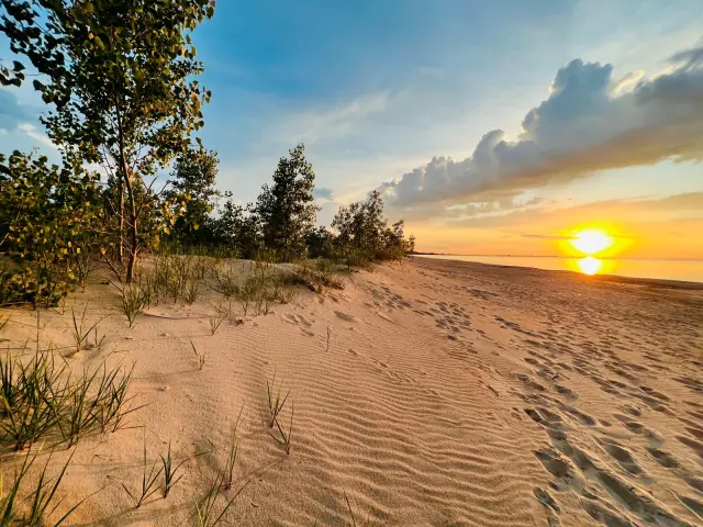
Imagine two photographs showing a larger sand mound in the second image. The images document a change in appearance, but they do not by themselves establish the source of the added material or the complete budget. A fuller explanation needs context about wind, waves, sediment supply and the interval between the pictures. This is why repeated measurements can answer questions a dramatic single image cannot.
Separate mechanism from prediction
Understanding that wind transports sand does not provide a forecast for a specific dune. A prediction requires the relevant conditions and evidence. This article explains the mechanism without assigning a movement rate, future shoreline or property-level outcome to Miller Woods.
Wind both builds and removes landforms
The NPS explanation of aeolian landforms uses the term for features shaped by wind. Deposition and erosion are both part of the process. A dune records accumulated sediment; a wind-eroded hollow records removal. Open sand should therefore be read as part of a changing system, not automatically as an unfinished or damaged forest.
A landform name describes a pattern
Names such as dune, ridge and blowout help describe form and process. They are not interchangeable labels for every sandy rise or depression. When reading an interpretive panel, connect the term to the explanation given there. If a source describes a wind-eroded hollow, do not silently turn that into a statement about the origin of every pond in the surrounding area.
A helpful conceptual exercise separates three stages: material becomes available, a transporting force moves it, and a local condition favours accumulation or removal. Those stages make an explanation testable. Instead of saying the wind made this, a researcher can ask where the sediment came from, how it moved and why the feature developed in that position.
Different evidence answers different parts
A surface photograph can reveal shape; a sediment sample can describe material; repeat surveys can document change. None alone supplies the whole explanation. Read a geological account for the combination of evidence it uses, not simply for a memorable name attached to a feature.
Plants can help create the surface they occupy
The USDA Natural Resources Conservation Service's native-grass reference describes American beachgrass, Ammophila breviligulata, as a strongly spreading grass with underground rhizomes. Its growth form helps explain the connection between vegetation and shifting sand. A rhizome is an underground stem, not simply another word for a root.
Read aboveground and belowground structure together
Visible shoots are only part of the plant. Underground growth allows connected shoots to occupy a wider area, while the surface vegetation interacts with moving air and sediment. That relationship is more informative than treating every tuft as an isolated plant sitting on a pre-existing mound.
In a conceptual feedback, vegetation changes the near-surface conditions that affect sand deposition; the changed sand surface then affects plant growth. Feedback means the result of one process becomes an input to another. It does not imply unlimited growth or a fixed outcome under every condition. Burial, exposure and disturbance still matter.
Use the species example without making an occurrence claim
A species reference explains traits and processes. It is not a dated inventory of every plant at Miller Woods, and this article does not identify a plant from an unseen photograph. The important lesson is functional: plants can be participants in landform development, rather than decoration added after geology has finished its work.
Ridges and swales explain the landscape's mosaic
The NPS succession account specifically identifies Miller Woods with a pattern of dune-capped ridges and lower swales. It describes the depressions as interdunal or interridge wetlands. This provides a useful local explanation for the close arrangement of contrasting habitats: a small change in relative elevation can place the ground differently in relation to water.
A conceptual cross-section
Picture a simplified line across a ridge, a depression and another ridge. Add a line representing groundwater level. Where the land surface is well above that line, conditions differ from a low place close to it. If the groundwater line changes, the relationship changes even though the ridge has not moved. This is an explanatory diagram in words, not a measured cross-section of Miller Woods.
The model helps avoid treating a wetland as an unrelated puddle beside a dune. The landforms and water system belong in the same explanation. It also shows why an apparently small physical alteration can matter: changing a depression's elevation or drainage can change its relationship with water.
Retain the local terminology
The same NPS account distinguishes several wetland settings, including coastal pannes and older inland interdunal systems. Do not call every wet depression a panne. Use the name supported for the particular feature, or retain a broader description when the origin has not been established.
A pond's water is not necessarily supplied only from above
A USGS investigation of dunes and wetlands along southern Lake Michigan describes groundwater moving through a layered sediment system. Its conceptual model includes local flows from dune-beach complexes towards adjacent wetland depressions, alongside broader flows. The study is regional and historical; it is not a live measurement of a named Miller Woods pond.
Groundwater is part of the landscape explanation
Thinking only about rain falling directly onto a pond misses possible connections through the ground. A useful water account asks about inputs, outputs and storage. The pond's visible level is one observation within that account, not a complete explanation of where its water originated.
The NPS Groundwater Sustainability Program treats groundwater-dependent ecosystems as resources whose flow and chemistry matter. That is a reminder to consider the water's properties as well as its presence. Two places with similar-looking standing water need not provide identical conditions for living communities.
Keep a model's limits visible
A regional hydrological model helps identify questions and plausible connections. Establishing the direction or rate of flow at a particular location requires the relevant observations and analysis. It would be misleading to assign a flow direction to every depression simply because a general diagram shows one.
A wetland can change appearance through the year
Indiana's Department of Environmental Management explains that wetlands may be flooded permanently, seasonally or intermittently, and that some have periods without visible surface water. This is why one photograph of dry-looking ground cannot establish that a place has ceased to function as a wetland.
Distinguish a state from a pattern
The water visible on one date is a state: the condition at that moment. The pattern across time includes how often, how long and in what season water is present or the soil is saturated. Ecologists use that longer pattern to understand a habitat. An isolated observation can be accurate while supporting only a narrow conclusion.
The NPS overview of non-tidal wetlands also distinguishes marshes, wet meadows and other freshwater settings. These categories describe differences in water, soils and vegetation; they are not a collection of synonyms for any place containing water.
A useful comparison
If two dated images show different water coverage, first ask whether they depict the same place, season and view. Then consider the information needed to explain the difference. The images can establish that appearances differed. They do not, without further evidence, establish a permanent ecological trend or identify its cause.
Wetlands are functioning parts of a wider system
The EPA's wetland explanation identifies water storage, water-quality functions, habitat and food-web relationships. These functions arise from interactions among water, soils, plants and other organisms. A wetland's value is therefore not measured only by the amount of open water that makes an attractive photograph.
Follow the connections
Dead plant material can become part of a food web rather than simply disappearing. Water can be stored and released over time rather than passing through an area at one constant rate. These are process explanations, not promises that every wetland performs every function equally or removes every contaminant.
Consider a hypothetical restoration assessment. A larger visible pool might be one result, but the assessment could also examine vegetation, water regime or the conditions needed by particular organisms. More water is not an automatic score of success without a defined ecological objective. The same applies to more trees or more bare sand elsewhere in the landscape.
Function is not an individual safety determination
General ecological benefits do not establish drinking-water quality, swimming suitability or conditions at a nearby property. Those questions need their own current evidence. Keep the ecosystem explanation distinct from a practical health or regulatory decision.
Dead plant material is part of a living food web
The EPA's wetland account explains how leaves and stems break down into detritus, contributing food to small organisms which are themselves consumed by others. This connects the physical setting with biological activity. A layer of dead material can be part of an active system rather than an absence of life.
Trace a pathway without inventing a local census
A conceptual pathway begins with plant growth, continues through dead organic material and its consumers, and connects with other feeding relationships. It is a model of how material and energy can pass through a wetland community. It does not identify which individual organisms occupied a particular Miller Woods pool on a given date.
| Part of the system | Question to investigate |
|---|---|
| Plant production | Which living communities supply organic material? |
| Dead material | Where does it accumulate, move or break down? |
| Consumers | Which organisms use that material or feed on other organisms? |
| Water regime | How might changing conditions alter those relationships? |
Explain connections rather than ranking appearances
A clear-looking pool, a patch of vegetation and accumulated leaf material reveal different aspects of a setting. Appearance alone cannot rank their ecological importance. A useful account asks how the components interact and which observations support the explanation. The same approach works across the mosaic: a habitat's role includes its relationships with other parts of the landscape, not simply the most conspicuous thing within it.
For a school or personal reading project, draw the supported links and leave uncertain links as questions. That produces a more informative diagram than a list of impressive species names assembled without evidence that they belong to the same place or time.
Black oak savanna is an open habitat with its own identity
The NPS black oak savanna account describes an ecosystem combining scattered oaks with prairie vegetation. It identifies Miller Woods and Tolleston Dunes as restoration areas and explains how a denser woody understorey can shade out plants associated with the open habitat. Savanna is therefore not simply an incomplete forest waiting to be finished.
The arrangement of vegetation matters
Counting trees alone misses the structure. The spacing of the canopy and the composition below it help define the habitat. A photograph showing open space between trees can be evidence to interpret, rather than evidence of failure to grow a forest. The question is which community and conditions the site supports.
The NPS page is an older restoration overview. Its acreage and species references should not be treated as a current project-status dashboard or a promise of a particular animal's presence. Here it supports the habitat explanation and the reason management may seek a more open structure.
Read woodland and savanna descriptions carefully
Similar tree species can occur in differently structured communities. Keep the habitat term attached to the source's description instead of assuming a tree name defines the entire ecosystem. The relationship between canopy, ground layer and disturbance is the explanation to look for.
A species' response is more complicated than a label
The US Forest Service's black oak review describes its relationship with light, competition and fire. It notes that smaller stems can be killed aboveground while the plant resprouts, and that response depends on factors including size and fire severity. Calling a species fire-resistant should not be read as saying every individual survives every fire unchanged.
Separate the stem from the organism
Aboveground change and whole-plant death are different outcomes. That distinction matters when interpreting a treatment report or comparing photographs. A reduced number of visible stems immediately after a disturbance does not by itself describe the longer response of the vegetation.
The species review is a synthesis of research from several places and periods. It is useful for understanding possible mechanisms, but an experiment elsewhere is not a measurement at Miller Woods. Keep location, treatment and observation period with any result you use.
Ask a more precise question
Instead of asking whether fire helps or harms oak, ask which plants, under which conditions, over what period and for which management objective. Those questions turn a broad slogan into an explanation that can be compared with evidence.
Disturbance can maintain the habitat managers want to conserve
The park's prescribed-fire explanation identifies planned fire as a vegetation-management tool and describes monitoring its effects. The wider NPS fire guidance distinguishes prescribed fire, carried out under an approved set of conditions, from an unplanned ignition.
The ecological question is about the regime
One fire is an event. A fire regime concerns the pattern of events and their characteristics over time. That pattern helps explain vegetation structure. A management discussion should therefore identify more than whether fire occurred: it should explain the objective, conditions and response being considered.
For an open habitat, allowing every woody plant to establish without intervention can change the conditions for ground-layer plants. Conversely, disturbance without the relevant planning or ecological objective is not automatically conservation. The relationship depends on the system and the outcome being sought.
Monitoring turns an action into a learning process
A treatment is not proof of success merely because it was completed. Comparing the intended objective with measured responses allows managers to decide whether to continue, change or investigate. This article explains the distinction; it provides no instructions for conducting a burn and makes no claim about a scheduled treatment at Miller Woods.
Succession is change through time, not a ladder of better habitats
The NPS account of Henry Chandler Cowles connects the Indiana dunes with the development of ecological ideas about succession. It also describes his recognition that disturbance and a changing environment complicate any fixed endpoint. This history is useful because it frames ecology as the study of relationships and change.
Space can suggest a history, but it is not a time machine
A series of different communities across a landscape can suggest stages in development. Researchers still need evidence that the sites form a meaningful comparison. If two places differ in water supply, treatment or substrate, those differences can influence the result as well as age. A sequence on a diagram should not erase those conditions.
Nor should succession be interpreted as a ranking in which woodland is always superior to open dunes or wetland. Each community can have its own ecological significance. Conservation may seek to retain a mosaic, including conditions which would change under a different disturbance regime.
Use the concept to improve a question
Ask what changed, which conditions changed with it and how the evidence distinguishes possible causes. That is more informative than assigning every site a final destination. It also makes room for the active management of savanna within a landscape where other areas support different communities.
The story continues beneath the visible vegetation
A 2025 USGS-listed study of Indiana Dunes soil bacteria examined samples collected in 2015 and 2017 across a dune chronosequence. The published summary reports changes in soil chemistry and organic material across the sampled stages. It concerns the broader park study, not a new species inventory or a sample collected for this GaryCity article.
A recent publication can contain older observations
Keep publication year separate from sampling years. The date a paper becomes available describes the research record, not necessarily the condition of the landscape on that date. This distinction is essential when using a scientific result as context for present-day interpretation.
The study also shows why ecology is not limited to naming large plants and animals. Soil properties and microbial communities provide another scale of investigation. A reader cannot infer those results from the colour of the surface alone; they depend on sampling and analytical methods.
Do not turn one measure into the whole ecosystem
A study may report several variables with different patterns. Read which measure changed, what comparison was made and what the authors conclude. Avoid replacing a specific result with a sweeping statement that one habitat contains more life or is healthier in every sense.
Restoration is a continuing process with explicit objectives
The NPS invasive-plant account describes a restoration example at a West Beach panne in Indiana Dunes, comparing an invaded site with later conditions after repeated work. It stresses follow-up treatment. This is a regional comparison, not a claim that the pictured project is at Miller Woods.
Distinguish the action from the result
Removing a target plant is an action. Establishing the desired community and maintaining the conditions it needs are outcomes to assess. A completion photograph can document work, while later monitoring asks whether the ecological objective persists. Those are related but different records.
The example illustrates why one treatment need not finish a project. Remaining propagules, later arrivals or changing conditions can require further attention. The correct interpretation comes from the project's own methods and monitoring, not from assuming every open patch means recovery is complete.
Keep project geography and date visible
A report about one panne, savanna unit or restoration programme does not describe every site in the park. Retain the named area, treatment period and measured response. This makes success stories useful evidence while preventing them from becoming a blanket claim about today's landscape.
Read official landscape information as evidence
| Source type | Useful evidence | Question to retain |
|---|---|---|
| Habitat overview | Definitions and characteristic relationships. | Does it describe the named site or the wider region? |
| Geological map | Mapped deposits and interpreted landform history. | Which unit, scale and date does the statement concern? |
| Research paper | Methods, sampled comparisons and stated results. | When and where were the observations made? |
| Restoration report | Objective, treatment and monitoring response. | Is this a proposal, completed action or measured outcome? |
| Photograph | A documented appearance from one view and time. | What remains outside the frame or cannot be measured visually? |
Build a short explanation without overclaiming
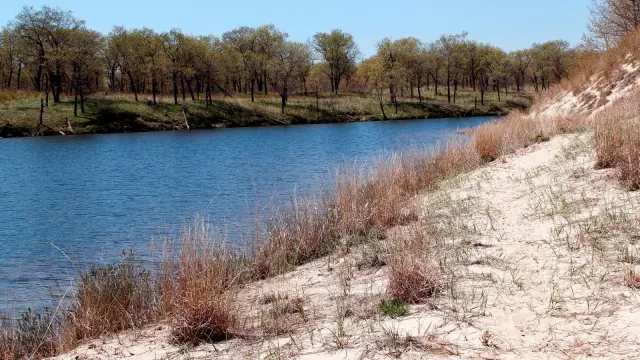
Write one sentence describing the feature, one explaining the supported process and one stating the remaining question. For example, a hypothetical image can show a low wet area beside a sandy ridge; an official account can explain ridge-and-swale hydrology; the depth and seasonal behaviour of that particular wet area remain matters for evidence. Keeping those sentences separate makes the explanation both useful and honest.
Use the landscape as a network of relationships rather than a collection of scenic objects. Sand, water, plants and management each provide part of the account. The reward is a better question about Miller Woods: not simply what is there, but how the conditions supporting it are connected.
Questions about the Miller Woods landscape
Why can a wetland lie next to dry-looking sand?
Relative elevation, groundwater and surface-water conditions can differ over a short distance. The ridge-and-swale explanation connects those differences. The exact water regime at an individual depression still requires local evidence.
Is black oak savanna simply young forest?
It has its own open structure and associated community. Management can seek to retain that structure rather than allow a denser canopy to develop. Habitat value is not a ranking from open ground to mature forest.
Does ecological succession follow one inevitable route?
Use it to understand change and relationships, while retaining the effects of water, substrate, disturbance and history. A useful model does not erase differences among real sites or prescribe one desired endpoint.
Does an older restoration page confirm present species populations?
No. A species example or project description has its own date and scope. Current occurrence and population questions need the relevant monitoring evidence. No animal sighting is invented in this article.
Where are the practical visiting details?
The Miller Beach guide owns practical route and site information. This article explains the landscape processes so the two pages serve different purposes. The history guide covers the wider human chronology.