Find the address first, then choose the right map
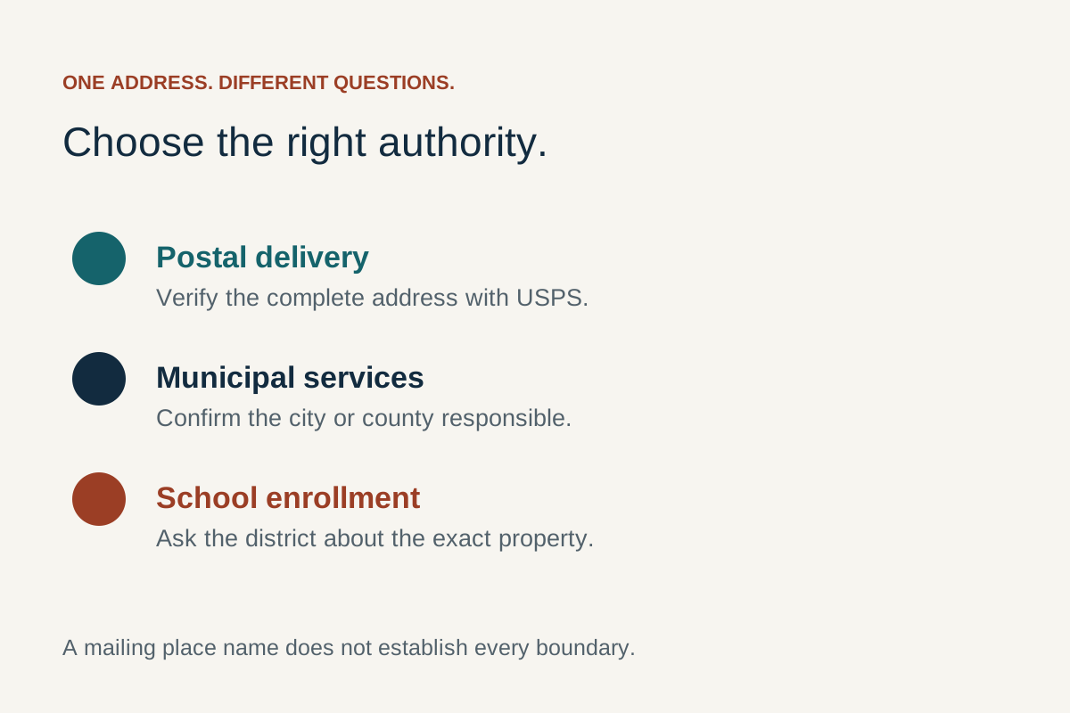
For a mailing ZIP code, use the USPS ZIP Code Lookup with the full street address and state. For a property, use the responsible county's parcel records. For a school, utility or municipal-service question, confirm the address with that organisation. These searches can describe the same home differently because they answer different questions.
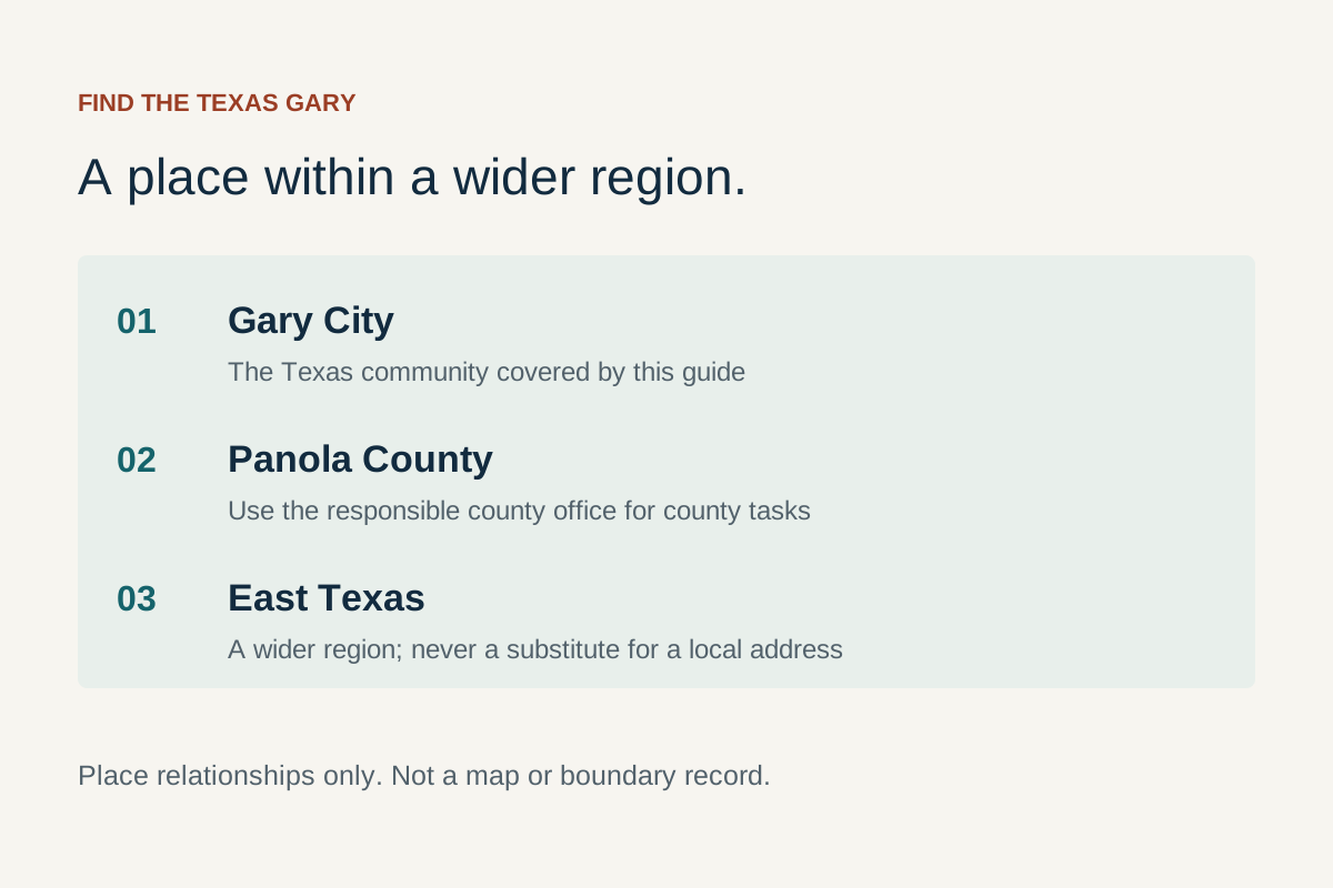
Choose Gary, Indiana or Gary City, Texas before searching. Gary, Indiana is associated with Lake County; the Texas city directory places Gary in Panola County. Adding the state prevents a convincing result for the wrong community from becoming the starting point for the rest of your research.
| Your question | Start here | Keep this result |
|---|---|---|
| What ZIP code belongs on this letter? | USPS address lookup | The matched mailing address, including the unit. |
| Which Indiana parcel is this? | Lake County's official search links | Parcel identifier and the address attached to it. |
| Which Texas property record matches? | Panola County Appraisal District | The property identifier and selected record. |
| Is this address covered by a city service? | The city or responsible service office | An address-specific answer identifying the provider. |
| Where should I arrive? | The destination's official visitor instructions | Physical entrance, access arrangements and return route. |
This guide explains how to make those routes work together. It does not collect your address, generate a boundary ruling or replace a survey. Source review: . Official tools open on their own sites, where their current instructions apply.
Build one small address note
Copy the address as supplied, the state, the task and the date into a private note. Add a parcel identifier only if the task concerns land. Add a unit only when the address actually includes one. Keep the original wording alongside any standardised result so that a changed abbreviation does not erase evidence of what you initially searched. This small habit makes a failed search much easier to explain.
Understand the four kinds of place name
A city name describes one entity, not every surrounding service
The City of Gary's own introduction is the municipal starting point for Indiana. In Texas, the East Texas Council of Governments directory lists the City of Gary in Panola County and gives 75643 as its primary ZIP code. Federal statistical searches may label the Texas place “Gary City town, Texas.” Preserve the source's exact label when recording a result, especially when comparing datasets.
A neighbourhood, school district, postal city and incorporated municipality are not interchangeable units. A useful question is therefore not simply “Is this Gary?” but “Which geography determines the answer I need?” For sending a parcel, postal recognition matters. For a proposed building project, the responsible permitting authority matters. For an appointment, the physical entrance matters. A single city label cannot settle all three.
Postal areas and statistical areas have different purposes
The Census Bureau's ZCTA guidance explains that ZIP codes support mail handling, while ZIP Code Tabulation Areas provide generalised areas for statistical mapping. A ZCTA is built from census blocks; it is not an official municipal outline. Consequently, a map shaded by ZIP-related statistics should not be used to decide which city administers a particular property.
Write the geography next to every result: “mailing address,” “parcel,” “school attendance enquiry,” “city boundary” or “countywide search.” This makes disagreements easier to understand. Two results can both be useful without matching exactly. The mistake is carrying an answer from one system into a decision that belongs to another system without checking the connection.
Look up a mailing address without guessing its ZIP code
Use the address search for an individual destination
USPS offers address, city-and-state and reverse ZIP searches. For a specific home or business, choose the address route and enter the information you have. Include the street direction and apartment or suite when applicable. Read the returned address carefully instead of selecting a ZIP code merely because it is associated with Gary. A city-and-state search is useful for exploring postal names, but it is a broader question.
- Confirm that Indiana or Texas is selected before entering the street.
- Use the recipient's supplied house number and street name, retaining a direction such as North or West.
- Add the actual apartment or suite identifier; do not invent a unit to force a match.
- Compare the result with the recipient's information and resolve any meaningful difference.
- Save the matched postal format for mailing, while keeping a separate physical-arrival note if needed.
The lookup's own notes explain that a ZIP result does not confirm that a person or business is present at the address. That distinction is particularly useful when researching an old business name or visiting a recently moved organisation. Confirm current occupancy with the recipient rather than treating a successful postal result as a live directory listing.
Recover from a failed or ambiguous match
When more than one result appears, narrow the search with the full street and unit. Check a transposed house number, omitted direction or misspelt road name before changing the place itself. If you were given a business name, try the underlying street address rather than repeatedly altering the business spelling. Keep a note of the exact variation that worked.
If no result is convincing, stop short of choosing the nearest-looking address. Ask the recipient to confirm the mailing information, then use USPS's help route for an unresolved postal problem. A recognised neighbour's address does not establish delivery to yours. For new construction, move to the address-assignment workflow below; a failed postal search is a symptom to investigate, not proof that the building or parcel does not exist.
Research an address in Gary, Indiana
Lake County's official Find page separates assessor parcel records, property-tax records, recorded public documents and GIS requests. Follow the link for the question you need answered. A parcel record identifies the assessment record; a tax search concerns the account; a recorded document may explain a transaction. Opening all of them indiscriminately can produce information without resolving the original question.
Match a parcel before comparing maps
Search using the available address, then compare the returned street, municipality label and parcel identifier. If a building appears to occupy several outlined lots, record every relevant identifier and ask how the records relate. Do not assume the parcel clicked on the map includes the whole property advertised in a listing. The map's visual selection and the record's identifying fields should describe the same item.
For a Gary development question, the city zoning page provides zoning-map and verification-letter routes. Use the full parcel reference when contacting the department. A coloured zoning layer helps frame a question about a proposed use; an individual project may require a more specific written response. Ask what record applies to the proposal rather than interpreting the map colour as approval.
Know what you have not established
Aerial imagery can help orient a property, but it may show an earlier state of the site. A roof visible on an image does not confirm its present condition. A drawn lot line is not a surveyed boundary on the ground. Before measuring an improvement's position or relying on a fence, identify the type and date of evidence needed for that task. Keep property-specific decisions with the appropriate qualified person or responsible office.
For day-to-day city matters, use our authority-routing guide. A county parcel result is not a request for municipal service, and a city-service report does not update an assessment record. Distinguishing those actions prevents a useful lookup from being mistaken for an application already submitted.
Research a Gary City, Texas address or tract
The Panola County Appraisal District search supports identifying a property using fields such as address and property identifier. Use the record to establish which item you are researching. Land described informally as “near Gary” may need more information than a house number: obtain the property identifier from the person supplying the description before trying to infer its location from a broad search.
Keep a tract, a structure and an entrance separate
A tract can be the subject of a sale while a map pin refers to a structure or driveway. Ask which land is included, where legal access is documented and which entrance visitors should use. Those are three connected questions with different evidence. A straight line from a public road to a map pin is not a route description or an access right.
The Panola County office directory helps identify the county department for records or address-related enquiries. Ask the office which local authority handles the specific location. Do not infer jurisdiction from a Gary postal label, or send a project request to Gary, Indiana merely because a search engine ranked that city first.
Resolve a road-name discrepancy methodically
Retain the spelling from the source record and the spelling supplied by the owner or destination. Compare house numbers and the surrounding road network, then ask the responsible address office to resolve a substantive difference. Avoid silently substituting a farm-to-market road, county road or informal local name. The right correction is the one confirmed for the address, not the one that makes a consumer map search return a result.
For a proposed purchase or move, continue to the homes and land research workflow. That guide explains how to connect the location record with physical condition, services and a proposed use. The map is the beginning of the property file; it does not answer all the questions within that file.
Read the map's layers, dates and scale
Ask what each line or colour represents
Before relying on a map, read its title, legend and layer name. A road centreline, parcel outline, city boundary and school boundary can all appear as lines. Turning on several layers without reading them can make a screenshot look authoritative while making its meaning less clear. Keep only the layers needed for the question and note their labels in your research record.
| Map element | Useful question | Next check |
|---|---|---|
| Street network | Which roads connect the destination? | Current access, restrictions and the correct entrance. |
| Parcel layer | Which record is selected? | Identifier, documents and any survey needed. |
| Zoning layer | Which classification is displayed? | Current rules and a project-specific enquiry. |
| Aerial photograph | What physical features appear in that image? | Image date and present site conditions. |
| Statistical shading | Which dataset describes the area? | Geography, reference period and uncertainty. |
Zoom changes what you can see, not the reliability of the underlying evidence. A highly enlarged aerial image can still be old. A detailed parcel outline can still be unsuitable for setting a boundary marker. When exporting or saving a screenshot, retain the legend, source and visible scale. An isolated crop loses the information another reader needs to interpret it.
Compare maps without forcing them to agree
Use one recognisable location as an anchor, then check that both maps show the same place and date context. Look for different layer purposes before assuming an error. If the disagreement affects a permit, purchase or service decision, send the two identified source records to the responsible office with a specific question. “Which boundary applies to this request?” is more productive than asking why the internet shows different pictures.
Handle a new, changed or unrecognised street address
USPS's new-construction guidance says local government entities assign street addresses and report them for postal use. USPS does not determine land use or zoning. This provides a useful sequence: establish the locally assigned address first, then resolve its postal recognition. An address that works in one private company's form may still be recorded differently elsewhere.
Create an evidence packet for the correction
Keep the local assignment document or official confirmation, the parcel identifier and the complete address. Record which system rejects it and what the system actually says. “No result,” “invalid unit” and “service unavailable” are different problems. Include the date, because a newly assigned address and a longstanding address with a typo require different follow-up questions.
In Indiana, begin with the appropriate city or county route for the location; in Texas, use the Panola County directory to identify the address-assignment contact for the tract. Ask which authority owns the record rather than assuming that the postal city is the assigning government. Then follow the official postal help process if the locally confirmed address remains unrecognised for delivery.
Do not overwrite unrelated records
A corrected mailing format should not automatically replace a legal property description, the name of an account holder or an emergency entrance instruction. Keep the purpose of each field clear. If you are helping someone else, ask them to approve the information before they submit it to the relevant organisation. GaryCity provides the workflow; it does not change government, postal or provider records on your behalf.
Use an address to ask about schools and services
School questions belong with the responsible school organisation
For Indiana, the Gary Community School Corporation website provides registration and school-contact routes. For Texas, use Gary Independent School District. These links identify organisations to contact; they do not establish that every home with a Gary mailing address has the same attendance position. Confirm the exact address and the student's circumstances with the appropriate organisation.
Ask a precise first question: “Which office can confirm the attendance position for this address?” Once that is settled, ask about enrolment, required documents, transport and any relevant support. Keep a school-choice discussion separate from a property record. A nearby campus symbol on a map tells you where the campus is, not whether a particular student can attend it.
Service availability needs the individual location
For internet research, the FCC explains that its broadband map shows provider-reported availability, rather than network performance or affordability. Use that as a lead, then ask the provider what can actually be ordered at the address. Save the quoted plan, installation conditions and date instead of treating a coloured area as a completed connection.
Use the same evidence habit for other services: identify the provider, ask about the address and record the answer. A neighbour's connection is useful context but not a contract for yours. If a provider's database has the wrong building or unit, describe that location mismatch explicitly. Changing the spelling in a sales form may produce a quote for the wrong place instead of solving the underlying problem.
Turn an address result into a workable arrival plan
Use a destination's official visitor page to confirm its public entrance. A mailing address may point to an administrative office, and a large site may have separate entrances for staff, deliveries or events. Put the arrival instruction next to the address rather than expecting the navigation pin to communicate it. For a school event, ask the organiser which door or parking area visitors should use.
Plan the final part of the journey
For Indiana rail travel, compare the station and attraction as separate destinations. The South Shore Line station guide is the operator's starting point for identifying the correct station. Continue with our Chicago transport guide for the planning workflow. A station being in Gary does not establish that a particular attraction is a short or accessible walk from it.
For a rural Texas visit, confirm where the entrance meets the road and whether an appointment is expected. A map can help locate a turn, but access instructions should come from the destination or responsible operator. Do not drive onto a neighbouring tract while trying to follow a pin. If the destination cannot explain its entrance clearly, resolve that before beginning the visit.
Keep a usable fallback
Save the street address, destination name and contact route in text, so they remain readable if a map app does not load. Record an agreed meeting point if members of the group arrive separately. For an unfamiliar public building, confirm accessibility arrangements directly: a nearby parking symbol does not describe the surface, entrance or distance required by an individual visitor.
Before leaving, also identify the return destination. A good arrival plan considers the whole trip, including the station, pickup point or route home. This is especially useful when an event ends after ordinary office hours and there will be fewer people available to clarify a mistaken entrance.
Three worked examples
Example one: a letter to an Indiana organisation
You have a Gary organisation's street address but no ZIP code. Confirm its current postal address on its own website, then use USPS's address lookup with Indiana selected. Compare the returned number, street direction and unit. Keep the standardised mailing format, and ask the recipient about any unresolved difference. You have now checked a mailing task; you have not established property ownership, attendance eligibility or a visitor entrance. Those extra searches would add work without helping the letter reach its recipient.
Example two: a Texas home advertised with a Gary address
Start with the supplied address and ask for the property identifier. Match that identifier in the Panola appraisal search, then keep the listing's included land separate from the map pin. Ask the appropriate office about jurisdiction and the district about school questions. Contact providers about the same address. The useful outcome is a set of linked answers for one property, rather than a broad list of facts about ZIP code 75643. Move to the property guide when you need to compare condition, costs and a proposed use.
Example three: a lakefront outing in Indiana
You want a walk at Miller Woods and a later stop elsewhere. The National Park Service's trail page identifies the Douglas trailhead at 100 North Lake Street, Gary, Indiana 46403. Save that location, then identify the second destination independently. Check current access and transport before connecting them. The plan works because it uses two verified destinations; it does not assume that every place described as Miller Beach shares one entrance or parking area.
In each example, stop once the original task has a defensible answer. More map layers are not automatically more useful. Expand the research only when the next decision requires a different record, such as a permit, an access arrangement or a provider's confirmation.
Use area statistics without turning them into address facts
Match the geography before comparing numbers
A map of population, housing or income describes the area named in its dataset. Before comparing Indiana and Texas, write down whether each number refers to a municipality, county, tract or postal-related statistical area. A larger area is not simply a more complete version of the smaller one: it can include different communities and a different mix of housing or land. The comparison should answer the question you actually asked.
For example, a person comparing two candidate homes might find one statistic under a city name and another under a ZIP code. Putting them side by side without checking geography would mix two definitions. A better worksheet has columns for the measure, area label, reference period and source. If those columns cannot be completed, keep the figure out of the comparison until you can identify it. This is especially useful when a property website displays a number without explaining its area.
Separate an area pattern from an individual condition
A regional statistic does not tell you the condition, price or internet connection of one building. Use the statistic to frame a broader question, then investigate the address itself. Similarly, a dot showing a school, park or station describes a location. It does not establish an entitlement, a suitable route or a service relationship with the home you are researching. Those connections need their own evidence.
When sharing an analysis, retain the original source label instead of simplifying every area to “Gary.” A reader should be able to see whether you compared Gary, Indiana with Gary City, Texas, or Lake County with Panola County. If the source uses a statistical name that differs from everyday usage, explain the distinction in a short note. This preserves meaning without forcing the data into the wording of a property advertisement.
Handle an unexpected dot on a broadband map
The FCC's location-challenge guidance distinguishes information about a building's location from the services reported for it. If a point appears over the wrong structure, first check the address and building information. A question about the location record is different from a question about whether a listed provider can connect the correct home.
Describe the mismatch precisely in your own notes: wrong building, missing unit, misplaced point or disputed service. Follow the appropriate official correction route if needed, keeping supporting material relevant to that issue. Do not submit an availability complaint merely to repair a misplaced location, or change a correct address to fit an incorrect point. The useful outcome is a clearer record of the intended building and a separate answer about service.
Keep coordinates attached to a named destination
Some official visitor pages publish coordinates as well as a street address. The NPS Miller Woods page is one such example. When using coordinates, copy the complete published pair and keep the source label beside it. Re-entering only part of the pair or dropping a sign can produce a result far from the intended destination.
Check the result visually before sharing it
After entering a published location, compare the displayed destination with the official address and visitor instructions. Name the meeting place in ordinary language as well: the public entrance, identified trailhead or agreed pickup point. A coordinate pair by itself does not explain where someone is permitted to park or which door they should use.
If a host supplies a custom meeting pin, ask what it marks and whether it differs from the postal address. Keep both when they have distinct purposes. Share the host's instructions with the other travellers so everyone interprets the pin consistently, rather than assuming that the map's suggested arrival point is the agreed meeting place.
Keep a useful record without oversharing an address
Store your research privately when it concerns a home. A small worksheet can contain the original address, matched result, source link, date, question and next action. Record a public office's reference number rather than copying a long exchange into an open document. If sharing a screenshot to ask for help, remove unrelated owner names, account numbers and personal correspondence.
Separate what you observed from what you were told. “The map displayed this parcel” and “the office confirmed this address is covered” are different evidence statements. This distinction helps another person reproduce your work and prevents a preliminary search from acquiring more authority as it is forwarded. Retain unresolved points explicitly instead of colouring them green because a nearby fact was confirmed.
A compact completion checklist
- The correct state and county are recorded.
- The lookup matches the task: post, parcel, boundary, school, provider or arrival.
- The returned record refers to the intended address or property.
- The source date and any unresolved mismatch are visible.
- The next organisation has the information it needs to answer the next question.
Questions about Gary maps and ZIP codes
Does Gary, Indiana have one ZIP code I can use everywhere?
Use the full-address lookup rather than a single citywide guess. A postal code associated with a public building is evidence for that building's mailing address, not a code to copy onto every Gary address. When checking someone else's address, confirm it with the recipient before mailing.
Is 75643 a map of Gary City's legal boundary?
No. It is the primary postal code listed in the regional city directory. Postal and statistical geographies do not establish municipal limits. For a property-specific city-service or development question, provide the exact address and parcel information to the responsible authority.
Why can a census search show Gary City while another source says Gary?
Sources label their entities for different purposes. Preserve the official geography label and state when using a statistical record, and keep the municipality or postal label appropriate to another task. A wording difference alone does not prove that one source refers to a different location.
Can I measure a property boundary using an online map?
A map is useful for orientation and identifying records. For a decision that depends on the boundary on the ground, obtain the appropriate survey or professional evidence. An enlarged screenshot and a ruler do not turn a map layer into that evidence.
Why does a provider reject an address that USPS recognises?
The systems answer different questions. Check whether the provider is rejecting the location itself, the unit or service availability. Ask the provider to resolve the exact mismatch rather than replacing the address with a neighbour's address. Keep any written response with the property file.
Where should I go after the address is confirmed?
Use homes and land for a property decision, local resources for authority routing, or the relevant Indiana or Texas city guide for a visit. Carry the confirmed address and the purpose of the next enquiry with you.