Reviewed . This article explains geographic concepts behind Gary, Texas place labels. It does not determine a particular address’s municipal, school or parcel boundary. For address lookup and correction tasks, use the maps and ZIP codes guide.
One place name can describe several different things
“Gary” can be a familiar community name, part of a mailing address or the name attached to an institution. “Gary City town” appears in a federal population table. These expressions need not compete for the role of one universally correct label. They can identify different objects, or describe the same location through different systems.
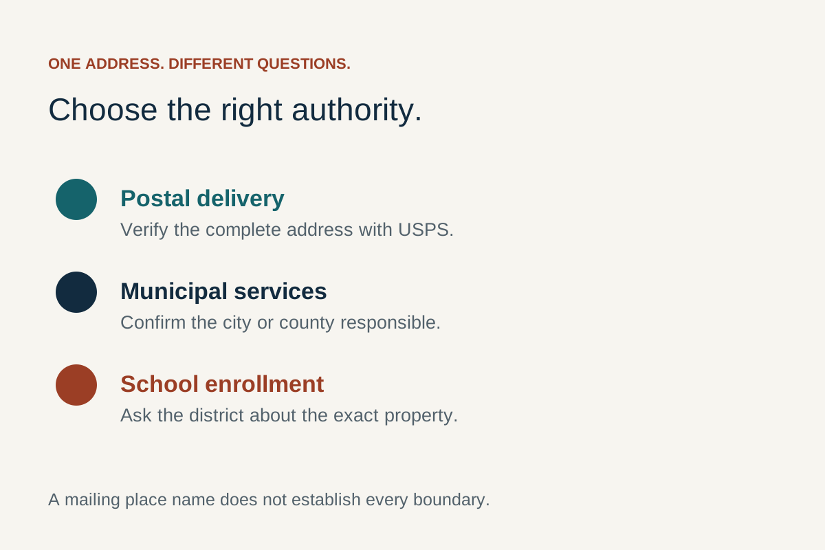
The important distinction is between a name and the thing named. A mailing name belongs to a delivery arrangement. A municipal name identifies a government or its territory. A school-district name identifies an education organisation and the geography relevant to it. A statistical name identifies an area for which a particular set of numbers is published.
This is why the answer to “Is this Gary?” depends partly on what the question means. Cultural familiarity, postal delivery, government responsibility and statistical inclusion are different relationships. Understanding them explains an apparent disagreement without assuming that every differing label is an error.
The layers differ in purpose, not simply in spelling
| Layer | What it describes | What the label alone does not establish |
|---|---|---|
| Postal city | A place name used in a mailing address within the postal system. | The municipality containing the delivery point. |
| Municipal place | A government and the territory described by the relevant boundary record. | Every area whose residents use a similar mailing name. |
| School district | An education organisation and its defined geography. | That a matching postal or town name assigns every student. |
| Statistical area | A geographic unit used to organise a particular data product. | A universal service area or a physical destination. |
| Property parcel | The particular land unit identified by the relevant property record. | A complete account of its postal, municipal and school relationships. |
| Community name | A way people identify a place or their connection to it. | A precise administrative boundary in every context. |
The differences persist even when the same word appears in every row. Replacing one spelling with another cannot make all the underlying purposes identical. Conversely, different displayed names do not necessarily mean that two records refer to different buildings or different people.
What the official Gary labels actually establish
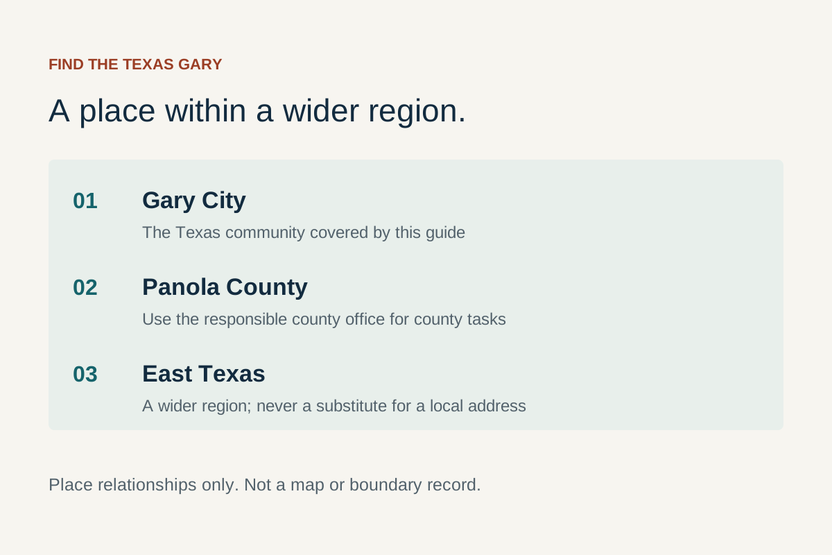
The East Texas Council of Governments directory lists the City of Gary in Panola County, with a Gary, Texas mailing address and primary ZIP code 75643. The Census Bureau’s 2020 incorporated-place table uses Gary City town. Gary Independent School District has its own institutional identity. These are observed source labels, not an inferred map showing every relationship among their boundaries.
“City of Gary” is the directory’s municipal heading. “Gary City town” is the named record in the cited Census table. “Gary ISD” identifies the school district. A reader can retain each expression in its own context without deciding that an extra word must be a typographical mistake.
The 2020 table is evidence about the named place in that dated product. It is not a fresh determination of today’s legal limits or the status of an individual property. Likewise, the regional directory’s primary ZIP is useful orientation but does not publish a complete correspondence between delivery addresses and municipal territory.
This article explains why such distinctions exist. The Texas city guide connects the names to practical local resources; it does not treat them as interchangeable authorities.
An incorporated place and a census designated place are different concepts
The Census Bureau’s geography definitions use “place” as a category covering incorporated places and census designated places. An incorporated place has a legal basis under the relevant state’s laws. A census designated place, usually shortened to CDP, supplies a statistical representation of a named settled concentration that is not incorporated.
The separate Census CDP explanation makes clear that a CDP is a statistical area rather than another municipal government. A single location cannot belong to both an incorporated place and a CDP. That particular rule does not mean every other kind of geography is mutually exclusive: a place can also be situated within a county and intersect other kinds of service or statistical areas.
The conceptual distinction is important because everyday language uses “town” more loosely. In conversation it can mean a recognisable settlement or a community. In a data table it can be part of an area’s formal description. The presence of a town name on a website therefore does not, by itself, identify which Census category that website means.
Gary’s cited record is in the 2020 incorporated-place table. This guide does not call it a CDP, and it does not infer a new legal status from the way another directory abbreviates its name. The national definitions explain the categories; the actual Gary table identifies the dated record being discussed.
A postal city belongs to the logic of delivery
USPS explains in ZIP Code: The Basics that ZIP codes reflect postal operations and need not follow municipal boundaries. The city name in an address can identify the delivery unit serving a destination rather than the destination’s municipality. Postal identity is therefore a functional relationship with a delivery system.
A mailing line is designed to help a mailpiece reach its recipient. It does not have to encode every institution associated with the recipient’s location. A school district, a property identifier and a municipal boundary are not alternative versions of the final line of a postal address; they are different information.
This also explains why an acceptable mailing name cannot be invented from a familiar local expression. USPS recognises postal names through its own records and procedures. A phrase that works in conversation does not automatically become a verified mailing alias. This article does not claim that Gary City, City of Gary and Gary are all acceptable USPS last-line names for every address.
The central point is explanatory: postal usefulness and municipal membership are different qualities. A correct delivery label can leave a government-boundary question unanswered. That does not make the delivery label defective; it means the question asks more than the postal system is intended to express.
Physical location and postal description are related differently
The Census Bureau’s USPS City Versus Census Geography explanation says a housing unit’s physical location determines its assignment to Census geography and political jurisdiction, rather than the mailing-city name. The bureau recognises that the two names may differ.
This separates the location of an object from a description used to communicate with it. A dwelling has a physical position even when several records describe its context differently. A mailing address is one way of identifying a destination; it is not the whole set of spatial relationships containing that destination.
For that reason, a mismatch between a postal label and a geographic table is not sufficient evidence that the table counted the dwelling in the wrong place. The two sources may use different assignment rules. The difference is meaningful before any conclusion about error is drawn.
The national Census explanation uses another community to illustrate the principle. Its illustration does not map Gary’s postal area, and we do not transplant its boundaries to Texas. It establishes why the relationship is possible, while a location-specific conclusion would need location-specific evidence. The concept is broader than any one town and helps explain why a familiar mailing name cannot carry every administrative meaning.
A ZCTA turns postal information into a statistical area
The Census Bureau creates ZIP Code Tabulation Areas, or ZCTAs, for mapping and statistical analysis. They are generalised areal representations of postal ZIP information, built with Census tabulation blocks. Postal ZIP information concerns delivery points and routes; a ZCTA provides an area that can be represented as a geographic unit.
For 2020 ZCTAs, an inhabited block is generally associated with the ZIP code used by the most addresses in that block. Not every valid ZIP code has a corresponding 2020 ZCTA. These details explain why “ZIP area” and “ZCTA” should not be treated as perfectly interchangeable technical terms.
The change of representation is the important idea. Postal delivery information becomes a defined statistical surface through a documented method. The resulting boundary is useful for a purpose, but it is not a newly created municipal limit or a school assignment line.
A five-digit label makes the relationship easy to recognise and easy to misunderstand. The shared digits suggest a connection; they do not erase the method used to create the area. A map shaded by ZCTA is a map of that statistical geography, not an official drawing of every carrier route or every address with a particular mailing name.
No 75643 ZCTA population or exact Gary-area postal polygon is supplied here. The article explains what the category means so that a postal statistic is not silently relabelled as a town statistic.
A point, an area and a label communicate different information
A point marks a position. An area has an extent and boundary. A name is an attribute that can be attached to either. Those simple distinctions explain much of the confusion created when a search result places one pin beside a town’s name.
A point can help represent an area on a screen, but it cannot show the area’s full shape. The same position can be inside several overlapping areas of different types. The point’s name does not explain which of those relationships a map designer intends to emphasise.
Equally, a shaded outline needs a definition. It may represent a municipal place, a district or a statistical area. The visual act of filling a shape does not make it a government boundary. Its meaning comes from the source and the category represented.
This is a distinction between the object and its symbol. A symbol can be clear and attractive while carrying less information than a viewer assumes. A labelled pin does not turn a large area into one destination, and a boundary line does not automatically describe the ownership of the land beneath it.
The Census Bureau’s Gazetteer record layouts illustrate the separation: an area’s name, identifier, land and water measurements, and internal-point coordinates occupy separate fields. They describe related aspects of the area rather than one interchangeable value.
A representative point is not necessarily the town centre
The Census geography glossary explains its internal points. For many areas the internal point is the centroid, or geographic centre. For some irregular shapes a centroid can lie outside the area; the bureau then identifies a suitable point inside the boundary, preferably on land.
That mathematical purpose is different from identifying a civic centre, a public entrance or the busiest part of a settlement. A coordinate can correctly represent an area in a dataset without being a destination selected for visitors.
A centroid is about the geometry being summarised. It is not a vote on which building matters most, where residents gather or where a government receives the public. The internal-point method also means that “centre” is an incomplete description when the point has been adjusted to lie inside an irregular boundary.
The useful distinction is between a reference position and the location of a particular feature. A town-level record can have a representative point while an individual school or office has a different physical position. Neither must be wrong. They refer to different objects.
No particular Gary pin is classified here as a centroid or internal point. That would require evidence about that pin’s data source. The concept explains why a town coordinate alone is not proof of a visitor location or a parcel’s relationship to a boundary.
An address match can be an approximation
The Census Geocoder documentation describes results derived from address ranges in its MAF/TIGER database. Coordinates are interpolated, or approximated, from those ranges. The documentation also notes that a range can contain possible structure numbers even where an actual structure does not exist.
This makes an important distinction between matching a description and observing a building. A matching address range is evidence that a system found a compatible record. It is not, by itself, a photograph, a field visit or a measured entrance.
The result can still be useful. Approximation is not synonymous with failure; many datasets deliberately represent information at a level suited to their purpose. Problems arise when the reader gives that result a stronger meaning than the method supports.
The Census explanation describes its own service. It is not a claim that every commercial map uses the same method or that every displayed Gary point has the same accuracy. The broader lesson is about interpretation: the way a position was obtained matters when deciding what the position can establish.
Coordinate precision and real-world accuracy are also different ideas. Displaying many decimal places describes the format of a number. It does not independently establish that the underlying location was measured to that precision.
A simplified boundary is designed to tell a broader story
The Census Bureau’s geography-tools guidance explains that cartographic boundary files simplify detailed geography for small-scale thematic mapping. They use fewer vertices to improve the appearance of shapes. The bureau cautions against using these files for address geocoding or precise geographic-area relationships.
A thematic map communicates a pattern across areas. It can be effective for showing a regional distribution while omitting detail unnecessary to that display. That is a design choice with consequences for interpretation, not evidence that the source intended a property-level boundary tool.
Enlarging a simplified map does not restore the information omitted during simplification. A smooth line remains a simplified line when zoomed in. A larger display can create an impression of detail without adding new observations or more accurate geometry.
This helps explain why two maps can look slightly different without either claiming to replace the underlying legal record. They may use different vintages, levels of detail or geographic products. Their suitability depends on the question they were designed to illustrate.
For Gary, this article makes no claim about a specific boundary’s position. The conceptual point is that scale and intended use belong to a map’s meaning. A pleasing outline can explain a community’s setting without being sufficient evidence for a decision about one site.
A geographic identifier adds something a name cannot
The Census Bureau’s GEOID explanation describes codes used to identify geographic entities and connect their statistics with the correct geography. Names are useful to readers; identifiers help distinguish records and their geographic levels.
The Gary City town row in the cited 2020 table has GEOID 4829108, composed there of Texas state code 48 and place code 29108. The code identifies that place record. It is not a street address, a ZIP code or a school-district number.
The conceptual value of an identifier is disambiguation. A short name can recur in several states, and similar names can occur at different geographic levels. A code interpreted in its proper system supplies context that a name alone may lack.
A number should therefore remain attached to its type. A five-digit postal code and a Census place code can look superficially similar while belonging to different systems. Equal length is not equal meaning. The field’s definition is part of the information.
Identifiers also do not remove time from the question. A record can retain a recognisable name while its geography or other attributes change. Correctly identifying the entity is essential, but the data product’s date and geographic definition still determine what a particular statistic describes.
Public institutions can organise the same landscape differently
A school district and a municipality have different institutional purposes. One concerns education administration; the other is a general-purpose local-government geography. A shared name is understandable because both are associated with the same community, but shared naming does not establish identical boundaries.
The National Center for Education Statistics’ school-district boundary documentation describes national differences in how district boundaries relate to municipal boundaries. It also distinguishes elementary, secondary and unified district geography. These are national concepts, not a finding about which side of a particular Gary boundary a residence occupies.
The Texas Education Agency locator explanation identifies mapped school and district information and cautions that positions are approximate and informational. Administrative boundary questions belong with the district. A general map and an administrative determination therefore have different roles.
Another distinction is between the location of an institution and the area associated with it. An office address marks a site; a district outline describes an extent. A school can be named for a community without its campus point explaining every household relationship across that extent.
Gary ISD’s institutional name is an actual local connection. This article does not derive enrolment, campus or transportation eligibility from it. Its purpose is to explain why the district’s geography remains a separate concept from the Gary postal name and the Census place. The calendar guide serves the separate school-year planning task.
A parcel describes a different unit of space
A parcel reference concerns particular land in a property-record system. A town name describes a different kind of entity, and a mailing line describes a delivery destination. The relationship among them is not established merely because the same name is displayed beside each.
The distinction is between identifying an object and describing its context. Land may have a parcel identifier, while a building on it has an address and its occupants use a mailing description. Those fields can be related without being substitutes for one another.
Similarly, a mapped parcel outline and a municipal outline answer different questions about space. One does not become the other when both are drawn with lines. The names, categories and source records explain the relationship the viewer is meant to understand.
This article does not interpret deeds, determine title, draw a surveyed boundary or decide a parcel’s current municipal status. It explains why a general label cannot settle those matters. The homes and land guide owns the practical property-research workflow; the explanatory point here is the distinct unit being represented.
A population number belongs to a defined population
The 2020 Census place table records 335 people for Gary City town. That statement contains three essential elements: the measure is people, the geography is the named place and the year is 2020. Removing any of them changes what the number appears to mean.
A school enrolment total describes pupils in an education system. A town population describes residents in a geographic unit. A postal-area statistic uses its own definition. Even if all three include Gary in their labels, they need not count the same set of people.
This is a denominator problem as well as a naming problem. A percentage or rate is meaningful only in relation to the population it describes. A count drawn from one geography cannot automatically supply the denominator for a different institution or area.
The same principle applies to comparisons. A larger number does not establish faster growth when the figures describe different areas. Apparent disagreement may reflect different populations rather than competing measurements of one population.
Overlapping geographies also cannot automatically be added together. A person can belong to more than one geographic grouping, so adding totals for those groupings can count that person twice. A set of separate categories forms a complete partition only when its coverage and lack of overlap are established. This is a general counting principle, not a measured relationship among Gary’s boundaries. It explains why several familiar local totals are not necessarily pieces that combine into a larger community population.
No current population estimate is supplied here, and 335 is not used as a count of all Gary postal customers or Gary ISD students. The history guide’s dated population table retains the years and source geography for its separate historical discussion.
A geographic definition also has a date
The Census Bureau’s Boundary and Annexation Survey collects updates to legally defined areas, including government boundaries and names. Geography is therefore not just a permanent container into which each new year’s numbers are poured. Some geographic records change over time.
A publication date, an observation date and a boundary vintage can refer to different aspects of a product. A webpage opened today can present a table describing an earlier population and an earlier geographic definition. The access date does not turn that information into a present-day measurement.
This matters when comparing a place with itself. A familiar name can make two records look directly comparable while their geographic coverage differs. A numerical change can involve changes in population, territory or measurement; the numbers alone do not separate those explanations.
Nothing in that general principle establishes that Gary underwent a particular annexation or boundary change. This article makes no such local historical claim. It explains why a rigorous comparison needs a defined object through time, rather than relying only on repeated spelling.
For the same reason, the 2020 Gary place record should retain its year even when used in an article reviewed in 2026. The review date describes our source review. The Census year describes the dated evidence being explained.
One short conceptual example
Consider a hypothetical location with a Gary mailing line, a municipal-area label M and a school-district label S. M and S are deliberately abstract; this is not a claim about any real Gary property. The labels describe three relationships: delivery, municipal geography and education geography.
Suppose a record displays only the mailing line while another displays M. The different text does not, by itself, prove that the records refer to different locations. They may be describing different relationships of the same location. Nor does learning S determine M: the district and municipality remain separate geographic questions.
The example also shows why a single “correct town” field can conceal ambiguity. It compresses several possible meanings into one slot. The problem is conceptual before it is clerical: the field needs a definition of the relationship it intends to describe. This example illustrates the logic without assigning a real address to any boundary.
Historical names add another layer of meaning
A historical place reference has the meaning available in its own setting. It may identify a community, a postal connection, an institution or the location understood by a writer at the time. A modern label does not automatically replace that historical context.
This is particularly relevant to Gary’s student-produced Loblolly publications, discussed in the history guide. The place of publication, the speaker’s birthplace and the setting of a remembered event can differ. They are separate facts even when one issue connects them.
Publication geography also differs from subject geography. A school community can preserve another community’s story. That contribution remains part of Gary’s history without relocating every interview subject into Gary. Understanding the relationship gives a more accurate account of the publication’s regional role.
A historical name is therefore more than a string waiting for a present-day replacement. Its date and context help explain what the source meant. A current postal definition can illuminate today’s system, while the meaning of an older record remains a historical question supported by evidence from the relevant period.
Questions about the meanings of Gary’s place labels
Can different labels be legitimate at the same time?
Yes. A mailing name, an institutional name and a geographic-area name can describe different relationships. Their difference becomes an error only when the evidence shows that a label is incorrect for the meaning actually intended.
Does 75643 describe exactly the same area as Gary City town?
This article does not establish that equivalence. The directory’s primary ZIP and the Census place belong to different systems. A shared local association is insufficient to prove identical boundaries.
Is a ZCTA a postal route drawn on a map?
It is a Census statistical representation built with tabulation blocks using postal information. Its method and purpose differ from the postal service’s delivery-point and route information.
Does a town pin mark its physical centre or city hall?
That depends on the pin’s source. A representative internal point has a geographic purpose, while a building point identifies a site. Neither the word centre nor a familiar name establishes a public entrance.
Does a matching district name prove school assignment?
No assignment is inferred here. A district is a separate institution with its own geographic and administrative context. Postal or municipal naming alone does not supply a student-specific determination.
Where is the practical address-checking process?
The maps and ZIP codes guide owns lookup, source selection and correction workflows. This article explains why the systems differ, so those tasks can be understood without treating every label as the same kind of information.